BEST VIEWED IN LANDSCAPE MODE ON MOBILE DEVICES
U.S.FTC GUIDELINES PLEASE NOTE: we act as an affiliate for several companies that feature on our website. In some cases we may earn a commission from referrals to those companies. For further information please refer to our Privacy and Disclaimer policies which can be found in the "About" tab.
U.S.FTC GUIDELINES PLEASE NOTE: we act as an affiliate for several companies that feature on our website. In some cases we may earn a commission from referrals to those companies. For further information please refer to our Privacy and Disclaimer policies which can be found in the "US" tab.
The Crown Range Road between Queenstown and Wānaka is one of New Zealand’s most spectacular drives
The Crown Range Road is the country’s highest sealed main road. It’s not just a way to get from Queenstown to Wanaka; it’s an experience in itself, with sweeping alpine views, historic gold-mining sites, character-filled pubs, and access to world‑class walking and biking.
And that's why it's one of our favourite short drives.
This guide covers
- Where the road starts and finishes
- Key access points and nearby towns
- Points of interest along the way
- Seasonal driving conditions and safety tips
- A short history of the road and area
- Practical information and useful links (including NZTA / Waka Kotahi)
- A "must view" video (look for the helicopter at around 2.17 into the video)

Overview: Why Drive the Crown Range Road?
The Crown Range
Road (officially part of State Highway 6) connects Queenstown and Wānaka
via an alpine pass across the Crown Range. At its highest point, the
road reaches about 1,076 m (3,530 ft), making it New Zealand’s highest
sealed main road.
Visitors choose this route because:
- It’s shorter and more scenic than the alternative route via Cromwell.
- The views are exceptional – especially over the Wakatipu Basin and Lake Hayes, and northwards towards Wānaka and the Southern Alps.
- It gives access to Arrowtown, Cardrona, and the Cardrona Valley, each with its own history and character.
- It’s an iconic South Island “must‑do” drive, similar in feel (though not in length) to famous alpine roads overseas.
Driving the Crown Range is not technically difficult in good weather, but it is steep, winding, and exposed, and conditions can change quickly, especially in winter. With a bit of preparation, most visitors can enjoy it safely.
Access Points and Route Overview
Queenstown Side
On the Queenstown side, there are two main access points:
1. Frankton / Queenstown
- From central Queenstown, follow State Highway 6A towards Frankton.
- At Frankton, turn onto State Highway 6 heading towards Cromwell and the airport.
- After you pass the airport area and cross the Shotover River, watch for signs to Crown Range / Arrowtown / Wānaka.
- Turn left onto Arrowtown–Lake Hayes Road (road to Arrowtown) and then follow signs for Crown Range Road / Wānaka.
2. Direct from Arrowtown
- From Arrowtown’s main street, drive out on Buckingham Street /
Arrowtown–Lake Hayes Road and follow the signs to the Crown Range
Road.
- This quickly leads to the sharp climbing section with multiple switchbacks and the main Queenstown viewpoint.
Queenstown
sits at the head of Lake Wakatipu, a hub for flights, rental cars,
tours, and buses. Many rental companies allow use of the Crown Range
Road, but some may have restrictions in winter, so always check your
rental agreement.

From the Wānaka Side
On the Wānaka side, access is straightforward:
- From central Wānaka, take McDougall Street out of town, which becomes Cardrona Valley Road (still SH6).
- Follow signs to Cardrona / Queenstown.
-
The road gently climbs through rolling farmland and then enters the
narrower Cardrona Valley, heading toward the Crown Range summit.
Wānaka
is a quieter, more laid‑back base than Queenstown, with excellent
access to outdoor activities. It’s also a popular stop on South Island
road trips.
Distance and Driving Time
- Queenstown – Wānaka (via Crown Range): 70 km
- Usual driving time: 1 hour 15 minutes to 1 hour 30 minutes in good
conditions, longer in winter or if you stop frequently for photos
(highly recommended).
Compared to the Queenstown–Cromwell–Wānaka route (around 110 km), the Crown Range is shorter and more direct, though also more demanding.
Points of Interest Along the Crown Range Road
Driving this road is about the journey. There are several places you’ll want to stop, stretch your legs, and enjoy the scenery.
Lake Hayes & Arrowtown Area
Just before you start the climb from the Queenstown side, you’ll pass close to Lake Hayes and Arrowtown:
- Lake Hayes – Often mirror-calm in the early morning or late
evening, with reflections of the Remarkables and surrounding hills.
There’s a walking track around the lake (Lake Hayes Walkway) that takes
about 2–3 hours.
- Arrowtown – A charming former gold-mining town only a few minutes’ detour off the main route.
- Historic main street, cafes, and boutiques.
- Restored Chinese miner village by the Arrow River, and an excellent museum.
- Excellent short walks, especially in autumn when the trees explode with colour.
You can easily combine a Crown Range drive with a morning or afternoon in Arrowtown.
Queenstown Lookout (Main Crown Range Viewpoint)
As
you leave Arrowtown–Lake Hayes Road and start climbing the Crown Range,
the road quickly gains height through a series of tight switchbacks.
Near the top of these bends is the main Queenstown Lookout (signposted “viewpoint”).
From here you get:
- Wide views over Lake Hayes, the Wakatipu Basin, and back towards Queenstown.
- On clear days, you can see the Remarkables range and Coronet Peak ski area.
There’s
a small parking area. The road here is narrow and busy in peak times,
so pull fully off the road and take care when rejoining the traffic.
Crown Terrace & Eastburn Road
Just
beyond the first summit and viewpoint, a side road (Eastburn Road /
Crown Terrace) heads off toward private farmland and rural properties.
Most visitors simply continue on the main road, but this area – known as
the Crown Terrace – is historically significant.
In the late
19th century, the terrace was farmed by European settlers, with
gold‑mining activity in the surrounding hills. Remnants of water races
and mining workings still exist, though they’re not always obvious from
the road.

The Summit (Crown Range Pass)
Continuing
on, you’ll wind along the side of the range before reaching the highest
point of the road, usually signed as the Crown Range Summit or Crown Range Pass.
Here you’ll find:
- A car park and viewing area with wide-open alpine views.
- A large Crown Range Summit sign, a popular spot for photos.
- Short informal walks if conditions are good (always stay clear of steep edges and respect private land).
From the summit, views stretch in different directions:
- Back to Queenstown and the Wakatipu Basin.
- Forward into the Cardrona Valley and towards Wānaka.
- Across to various peaks in the Harris Mountains and surrounding ranges.
In winter, this area can be very exposed with snow, ice, and strong winds. Be careful as you exit your car, as the ground can be slippery if covered in ice. Even in summer, weather can change rapidly.
Cardrona Valley & Cardrona Hotel
Descending
from the summit towards Wānaka, the road enters the Cardrona
Valley, a high-country valley with a rich gold‑mining and pastoral
history.
Key stop: Cardrona Hotel
- One of New Zealand’s most famous and most photographed country pubs.
- Established in 1863 during the Otago gold rush.
- Iconic historic façade on the roadside; behind it, a welcoming beer garden, restaurant, and accommodation.
- Great place for lunch, a coffee, or an evening meal if you’re staying nearby.
The Cardrona area is a hub for:
- Cardrona Alpine Resort access road (skiing and snowboarding in
winter, mountain biking and sightseeing in summer; the access road is
gravel for part of the way and steep – check conditions before driving).
- Horse trekking, quad biking, and 4WD tours in the surrounding hills.
- Distillery and brewery experiences (Cardrona Distillery offers tours and tastings).
Cardrona River & Historic Sites
As you follow the Cardrona Valley down towards Wānaka, you’ll see:
- The Cardrona River, once heavily worked by gold miners.
- Occasional historic buildings and ruins, remnants of the gold rush era.
- Shepherds’ huts and old farm structures that give a sense of the valley’s long agricultural use.
While many sites are on private land, information boards and occasional signs help tell the story of the valley’s development.
Approaching Wānaka
Closer
to Wānaka, the landscape softens from high-country tussock to more
gentle farmland and lifestyle blocks. Before long you’ll reach Wānaka
township with:
- Lake Wānaka, a stunning glacial lake ringed by mountains.
- Lakeside walks and biking tracks (be sure to see "That Wanaka Tree").
- Cafes, bars, and restaurants clustered around the waterfront.
- Puzzling World is wonderful for all ages.
Wānaka
makes an excellent base for exploring Mt Aspiring National Park, skiing
at Treble Cone or Cardrona, or simply relaxing by the lake.

Some great things to do around the Crown Range Road
The Crown Range Road opens up a world of adventure. Rather than using it as just an access road between Queenstown and Wanaka, we love to explore, and here's just a few of the attractions along the way:
Cardrona Valley Mountain Quad Bike Experience

Quad biking is a popular activity in the region, and this one is one of the best. Think wonderful valley, lake, and backcountry views, excellent guides, and modern Yamaha quad bikes with auto transmissions, and you have all of the ingredients for a fun-packed day.
Find out more and book your adventure here.
Cardrona Valley Horse Trekking Experience

For something a little more relaxed than a quad bike, a back country horse trek is the perfect way to relax and to take in some of the most beautiful country imaginable. This activity is suitable for riders of all skill levels, and the horses are selected for their calm nature.
Highly recommended. Book your trek here.
Crown Range Road Seasonal Driving Conditions and Safety Tips
The
Crown Range Road is safely driven by thousands of locals and visitors
every year, but you must respect the conditions. It’s an alpine
pass, and weather can be extreme – particularly in winter.
Summer (December–February)
- High UV levels – if you’re stopping outside, apply sunscreen and wear a hat.
- Afternoon heat may result in haze that dulls long‑range views; mornings and evenings are often clearer.
Driving tips:
- Watch for cyclists and motorcyclists, who are common in summer.
- Be wary of gravel on corners and occasional loose stones from maintenance.
- Hydrate and take breaks – there are no fuel stations directly on the pass.
Autumn (March–May)
- Often the best for photography, especially around Arrowtown and Lake Hayes, with spectacular autumn colours.
- Mornings can be crisp with possible fog or frost as the season progresses.
- Days are shorter; plan to avoid driving the pass in the dark if you’re unfamiliar with the road.
Driving tips:
- Expect frost on shaded corners, especially early in the morning or late in the day.
- Watch for leaf fall near tree-lined areas around Lake Hayes and Arrowtown (wet leaves can be slippery).
Winter (June–August)
This is when conditions can be most challenging:
- Snow, ice, and black ice are common, especially on the Queenstown side’s switchbacks and near the summit.
- The road can temporarily close during significant snow events.
- Chain restrictions may be in place – meaning you must carry and sometimes fit snow chains.
Driving tips:
- Use a 4WD / AWD vehicle if possible in winter, but remember: even 4WDs can slide on ice – drive slowly and smoothly.
- Always check the road status before you travel:
- Waka Kotahi NZ Transport Agency (NZTA) website for highway conditions & closures.
- Local information via Queenstown Lakes District Council and local radio.
- Carry snow chains and know how to fit them. Rental companies often provide chains and a basic demonstration if you ask.
- Avoid sudden braking or acceleration, especially on corners and descents. Use low gears for better control downhill.
- If you’re not confident in winter alpine driving, seriously consider taking the longer but lower Cromwell route (SH6 via Kawarau Gorge and SH8A), or
- Travelling by bus or shuttle with a professional driver.
Spring (September–November)
- Mix of winter-like days and mild, sunny days.
- Snow can still fall at higher elevations, especially early in spring.
- Meltwater can create wet patches and occasional small slips.
Driving tips:
- Treat early spring like winter at higher elevations – keep chains handy if travelling in September.
- Beware of runoff and potholes after heavy rain.

Crown Range Road - Characteristics and Driving Advice
Understanding the road’s character will help you drive it more comfortably.
Gradients and Corners
- The Queenstown side has steep, tight hairpin bends as it climbs from the Wakatipu Basin to the first viewpoint.
- The Wānaka side has more gradual gradients and longer curves, though still with some sharp corners near the top.
Take your time
- Use low gears going up and down to avoid overheating brakes and improve control.
- In New Zealand we drive on the left hand side of the road. Please keep to your side of the centre line, especially on blind corners – large vehicles and buses also use this route.
- Pull over in safe places if traffic builds up behind you.
- Be extra cautious in the cooler months as black ice can affect parts of the road, and forms in shaded gullies.
Overtaking and Pull‑Outs
- There are very few dedicated passing lanes.
- Use lay‑bys and viewpoints to let faster traffic pass. This is both courteous and safer.
- Do not stop on blind corners or in narrow sections – wait for a proper pull‑off spot.
Fuel, Food, and Facilities
- There are no fuel stations on the Crown Range road itself.
- Fill up in Queenstown, Frankton, Arrowtown, or Wānaka before driving.
- Toilets are available in Arrowtown, Cardrona, and Wānaka.
- Food & drink readily available in Queenstown, Arrowtown, Wānaka, and the Cardrona Hotel.
A Short History of the Crown Range Road
The Crown Range area has a long human history, from early Māori travel routes to European gold miners and modern tourists.
Māori Use
Before
European arrival, southern Māori groups travelled through the central
Otago region, following river valleys and passes for hunting, gathering
pounamu (greenstone), and trading. While exact routes vary, high passes
like the Crown Range would have been known and possibly used, though
lower routes were generally preferred where possible.
The Gold Rush Era
In the early 1860s, the discovery of gold in Otago triggered a wave of prospectors into the region:
- Arrowtown and the Cardrona Valley became bustling gold-mining communities.
- Tracks across the Crown Range connected miners between Arrowtown, Cardrona, and Wānaka.
- The Cardrona Hotel was established in 1863 and served miners, travellers, and farmers.
These early roads were rough and often impassable in winter, but they laid the foundations for the modern route.
From Farm Track to Main Road
Over decades, the route was gradually improved:
- Early 20th century: Road upgrades to support farming and small settlements.
- Mid–late 20th century: Work to seal the surface and make the road more reliable.
- 1970s–1990s: Tourism growth in Queenstown and Wānaka increased traffic, prompting further improvements, better signage, and safety barriers in critical spots.
The Crown Range Road is now an important regional connection as well as a tourist attraction in its own right.

Why Choose the Crown Range Route?
Comparing your options for travelling between Queenstown and Wānaka:
Crown Range (via Cardrona)
- Shortest and most scenic route.
- Highlights:
- Alpine views, lookout points, Cardrona Hotel, historic Arrowtown access, Cardrona Valley activities.
Best for:
- Self‑drivers comfortable with winding alpine roads.
- Travellers wanting a memorable, photogenic journey rather than just a transfer.
- Those staying in or visiting Cardrona.
Cromwell Route (via Kawarau Gorge)
- Travel Queenstown – Cromwell – Luggate – Wānaka.
- Longer in distance and time, but lower altitude and usually less affected by snow and ice.
- Scenic in its own right (Kawarau Gorge, vineyards), but no dramatic alpine pass.
Best for:
- Winter travel in poor conditions or when the Crown Range is closed/restricted.
- Travellers less confident on steep, narrow roads.
Many visitors choose to drive one way via the Crown Range and return via Cromwell, seeing both sides of Central Otago.

Practical Tips for Visitors
Rental Cars and Insurance
- Confirm with your rental company that driving the Crown Range is permitted under your agreement, especially in winter.
- Check your insurance coverage for damage from snow, ice, or unsealed side roads (like the Cardrona ski field access road).
- Inspect tyres before you go – good tyre tread is crucial in alpine conditions.
The Time of Day
- Morning: Often clearer, with calmer winds and fewer vehicles. Good for photography with softer light.
- Late afternoon/evening: Beautiful golden light, but be aware of:
- Sunstrike (low sun directly in your eyes).
- Rapid dusk in winter – avoid driving in darkness if unfamiliar with the road.
Travelling with Children
- The road has plenty of bends, which can cause motion sickness.
- If prone to carsickness, sit children in the front (if legal/appropriate) or middle seats, and take regular breaks.
- Use the viewpoints and Cardrona as rest stops.
Non‑Drivers (Tours and Buses)
If you prefer not to drive:
- Several tour operators and shuttle services run between Queenstown and Wānaka via the Crown Range, sometimes with planned stops.
- In winter, ski shuttles use the road daily, driven by experienced local drivers.
This can be a relaxing way to enjoy the scenery without worrying about road conditions.
Further Information and Useful Links
For the most current information, especially on road conditions and closures, use official sources:
Waka Kotahi NZ Transport Agency (NZTA)
Traffic, travel information (road status, closures, chain fitting areas, etc.) and general driving safety and road rules can be found on the NZTA site here.
Queenstown Lakes District Council (QLDC)
Has local updates, including winter driving advice and weather-related notices - access their website here.
MetService New Zealand
Weather forecasts and warnings for the region (Queenstown, Wānaka, and high-country forecasts) can be found on the MetService website here.
DOC (Department of Conservation)
Nearby walks, tracks, and conservation areas - learn more here.
Always cross-check multiple sources in winter, as conditions can change quickly.
Making the Most of Your Crown Range Road Experience
To turn a simple drive into a highlight of your South Island trip:
- Allow extra time – at least 2–3 hours so you can stop for photos, short walks, and perhaps a drink or meal at Cardrona Hotel.
- Plan a loop – go one way via the Crown Range and return via Cromwell for variety.
- Combine with Arrowtown – explore Arrowtown’s historic streets and riverside walk, then tackle the Crown Range in daylight.
- Check conditions carefully in winter – if the forecast is poor, consider delaying your trip or taking the lower route.
- Pack for the alpine environment – even a quick stop at the summit in summer can be windy and cool; in winter, it can be bitterly cold.
Done thoughtfully, the Crown Range Road isn’t just a connection between two towns – it’s a classic New Zealand alpine journey: a mix of history, scenery, and high-country atmosphere that many travellers remember as a highlight of their visit.
Here it is from a different perspective!
Several years back, "Mad Mike" Whiddett, a professional drifter, took to the Crown Range Road.
Here's a video of his amazing ascent. Around the 1.58 mark watch for the helicopter!
Enjoy.
Have A Great Story About The Crown Range Road?
Do you have a great story about the Crown Range Road? Why not share it!
You might like these
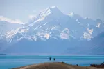
highest peak in new zealand
Aoraki Mt Cook is the highest peak in New Zealand at around 3,724 metres (around 12, 218 feet).
Historic Arrowtown should be a must see if you are in the region.
Historic Arrowtown is a beautiful village near Queenstown on New Zealand's South Island. It's filled with historical buildings, restaurants and amazing scenery.
Wanaka New Zealand
Welcome to stunning Wanaka New Zealand, where towering mountains gaze down on a mesmerising lake, in one of New Zealand's most beautiful towns.
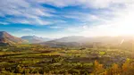
day trip to cromwell
Join us on an exciting day trip to Cromwell, experiencing some of the region's stunning landscapes and attractions.
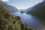
Doubtful Sound New Zealand
Doubtful Sound New Zealand is a stunning waterway located in the amazing Fiordland National Park New Zealand.
milford sound vs doubtful sound
Milford Sound vs Doubtful Sound. Which one should you choose? Of course we recommend visiting each if time allows. But if you can only visit one, here's all the information you will need to make a decision.
te anau new zealand
Te Anau New Zealand is the gateway to the World Heritage listed Fiordland National Park. This beautiful lakeside town is the perfect spot to base yourself while you explore Fiordland.
day trip to Glenorchy
A day trip to glenorchy is a must do if you are visiting Queenstown. Here's our suggestions on the highlights along the way
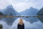
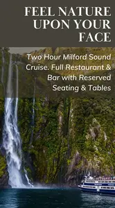
Milford Sound tours
Milford Sound was described by Rudyard Kipling as the Eighth Wonder of the World. Find out about Milford Sound tours right here.


Dave, Kim, and Tim Curran are New Zealand self-drive holiday specialists with a strong Queenstown focus. For 20+ years, they have been helping travellers plan bespoke New Zealand self-drive itineraries. Vacation Queenstown also offers visitors a unique trip planner to help them build their own New Zealand self-drive adventure. Dave is recognised by Tourism New Zealand as an Advanced Specialist. They love exploring New Zealand and helping others create their own adventure.
